|
| Hiking the Estero Trail, Point Reyes National Seashore |
Santa Clara, CA - On June 18th we were planning on doing a Minus Tide Hike up in Point Reyes National Seashore, however the required 4 a.m. start time persuaded most of the group to request an alternative (I actually liked the ideal of wading through the chilly ocean water at sunrise as long as little Keira was being babysat by her grandmother). Arturo, our instigator, quickly came up with a "Plan B", a hike out to Sunset Beach along the Estero Trail, with the possibility of going further on to Drakes Head or making a loop via the White Gate Trail. So, instead of 4 a.m. we all met at the visitor's center sometime around 9 a.m.
From the visitor's center its another 20 to 30 minute drive to the Estero trail head. Here are the directions if you are interested in checking it out:
From the visitor's center head north on Bear Valley Trail for 0.2 mile to Bear Valley Road. Turn left on Bear Valley road and go 1.7 miles to Sir Francis Drake Blvd. Turn left onto Sir Francis Drake Blvd. and go 7.6 miles. Then take a left at the "Estero Trail" sign and drive 1 more mile to the trail head.
Because we set out with a very adjustable plan, I'll break up the trail description into segments as we added to the hike.
Estero Trail Hike, Part 1 - Estero Trail Head to Sunset Beach
Length: 4.45 miles
Start and End Elevations: 153' - 0'
Max Elevation: 190'
 |
| Monterey Pine Forest at mile 0.65 |
|
From the parking lot the trail starts out meandering south through rolling hills of grass and scrub until it reaches a wall of Monterey Pine (0.65 miles). As you enter the pine forest the trail drops down to the edge of Home Bay, where the trail crosses a narrow isthmus and a foot bridge (1.2 miles). From here you follow the edge of the bay as you climb the west side of Drake's headland. The trail works it up and down rolling hills offering view of Home Bay and Drake's Estero.
 |
| Bridge at Home Bay at mile 1.2 |
 |
| Hiking up Drake's Headland |
An Estero, Spanish for Estuary, is a partly enclosed body of water with one or more or streams flowing into it, and with a free connection to the open sea. Estuaries form a transition zone between river environments and ocean environments and are subject to both marine influences, such as tides, waves, and the influx of saline water; and riverine influences, such as flows of fresh water and sediment. Drake's Estero encompasses about 2000 acres of sea grass beds and mud flats. When we were there the tide was slowly moving in and just starting to cover the area with sea water.
 |
| The Sunset Beach Trail as it drops to Drake's Estero |
 |
| Arturo faces down the cows |
At 2.55 miles you reach the Sunset Beach Trail. The trail then drops between two hills and passes to the left of a small lagoon. There are a number of free range cattle that may give you a dirty stare, but tend not to charge unless taunted (Arturo's fault!) At 4.00 miles the trail seems to end in a patch of Poison Oak next to a wood bench. If you work your way through sedge grass and pickleweed you can make your way down to the "beach". Yes, there is sand here, but it's well mixed with mud and rock.
 |
| Finding our way through the grass to Sunset Beach |
Hiking along Sunset Beach to the Point
You can follow the "beach" southwest along the edge of the Estero another half mile or so to a rocky point with views of Limantour Spit, Drakes Beach, Drakes Estero, Estero de Limatour, and the Pacific Ocean. At low tide you may be able continue around the point a bit further. We didn't as we had a lot more hiking that we wanted to do and didn't feel like getting cut off by the tides.
View from the Point
Estero Trail Hike, Part 2 - Sunset Beach to Drakes Head
Length: 4 miles
Start and End Elevations: 0' - 148'
Max Elevation: 243'
Most trail descriptions I've read list Sunset Beach and Drakes Head as separate out and back hikes. We were feeling quite light footed without the baby in tow and decided to link the two. Arturo also read that there is no way to hike directly from Sunset Beach to Drakes Head without returning to the Estero Trail. I think if you timed it right with the tides, this may not be true (however it does look very difficult and we weren't willing to risk being wrong). So, we returned the 2 miles to the Sunset / Estero Trail intersection and turned right to continue along the Estero Trail again.
At this point the trail just seems to take off across the cow fields. In 0.25 miles you reach a cattle tank where you must head left. It's a little confusing here because there are cow trails heading off in many other directions. Most intersections like this were marked with arrows, but this one seemed a bit fuzzy. Following the cattle fence and the arrows for another 0.5 miles will bring you to the Drakes Head Trail. Note here that the sign pointing to Drake's Head was easy to miss as it was obscured by tall grass and facing the other way.
 |
| Wild Flowers on the Drake's Head Trail |
The Drake's Head Trail follows well worn cattle trails through amazing fields of wild flowers for about 1.5 miles. You know you've reached Drake's Head when the ground in front of you abruptly falls into the the Estero de Limantour.
 |
| View of Limantour Split, Estero de Limantour, and Limantour Beach from atop Drake's Head. |
Personally, Drake's Head was the high point of the hike. Great views of the Estero de Limantour, the Limantour split, Limantour Beach (all named after French explorer Jose Yves Limantour, whose ship and crew were stranded on the spit in 1861), Drakes Estero, Drakes Beach, and Drakes Bay (all named for Sir Francis Drake who stopped here in 1579 for repairs and replenishment before continuing his circumnavigation of the world).
Snacks, snaps and naps were in order.
Estero Trail, Part 3 - Drake's Head to the Estero Trail Head via White Gate Trail
Length: Approx. 5.5 miles
Start and End Elevation: 148' - 153'
Max Elevation: Unknown
Still feeling pretty good we decided to press on along the Estero Trail to the White Gate Trail and return via the Estero Trail Road. I can't recommend this route as the 2 mile section along the Estero Trail Road passes through one of Point Reyes' historic ranches and is actually off limits to hikers. We didn't know this at the time. The problem was that we were using a map from Map Adventures instead of using the National Park Map. The difference being that on the National Park Map, the Estero Trail Road is shown to end at the trail head parking lot instead of continuing on to the White Gate Trail. All we could say at that point was, "oops."
In any case we hiked back the 1.5 miles along the Drake's Head trail to the Estero Trail then turned right. Another 0.7 mile brought us to the White Gate Trail. At this point we made another mistake, instead of following the White Gate Trail along the west side of the lagoon, we ended up following one of the cattle trails up the hill to the north. We just followed the contours and cow paths north until we hit the Estero Trail Road again (keeping the lagoon and the White Gate Trail to our right).
 |
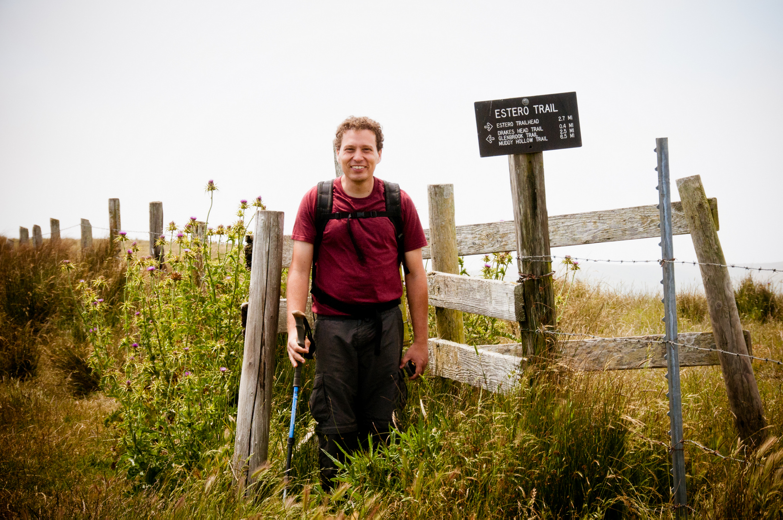
| Trail marker along the Estero Trail, Point Reyes National Seashore |
It wasn't until we hit the Estero Trail Road that we realized our mistake. There were, "No Hiking" signs posted there. It being after 5 pm at this point, we decided as a group to eat crow and hike the 2 miles along the road passing through the ranch, rather than return the 5 miles via the trail. Prepared to apologize to the ranch residents we tip toed rather inconspicuously through the complex. Only the fierce guard puppy seemed to notice us. I think others have probably made this mistake before. Once pass the ranch we only had a short climb up a paved section of road to return to the car. Overall a great hike.
 |
| Hiking Cross Country with the Estero de Limantour behind us |
Thanks to Arturo for putting this all together! And thanks to my mom for babysitting.
For a lot more photos follow the link below to the slide show:
And here's a link to Arturo's Slide show:
https://picasaweb.google.com/acrespo/PointReyesEsteroTrail