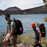
What I've learned from viewing that data, is that a majority of the traffic to this blog are not actually friends and family like I originally thought (although that is still a significant chunk of it), but rather folks looking for backpacking, travel and climbing trip reports. By far, the most popular post is the Buckskin Gulch & Paria River Canyon Hike , followed by our Bishkek to Kashgar Trek, and believe or not, a day hike we did on Mt. Sanitas in Boulder. I swear, these posts get at least 2 to 3 hits a day. That may not seem like a whole lot, but it adds up to a heck of a lot of people looking for hiking and traveling information.
The reason I bring this up now, is that I have another great hiking and traveling post for you all. Back in July, Suwei and I headed off with a group of friends to Victoria, British Colombia to hike the famed West Coast Trail. This is one of those classic world hikes, named "#1 Best Hike in the World" in the highly subjective Top 10 list on Besthike.com. We chose it out of our beloved "Classic Hikes of the World" book by Peter Potterfield, and as with most hikes in that book, it has been on our tick list for quite some time.
Granted, there is a ton of information out there on the web about this hike and I'm sure I won't be able to sum it up as well as others, but I still enjoy the process of regurgitating my experiences and sharing photos. If you are actually planning on doing the hike, I would recommend getting one of the WCT guide books. We used, "Hiking the West Coast Trail: A Pocket Guide" and it served us well. We made copies of the essential pages and brought it with us.

Anyway here is my trip report.
BACKPACKING THE WEST COAST TRAIL - JULY 3rd to July 11th, 2010
Trail Summary: Wow! Ok, I need to type more than, "wow". But, that is pretty much the way I felt from the moment I stepped onto the trail all the way up to the last ferry to Port Renfrew. As an avid backpacker I love a trail that continues to provide challenges, feels rugged and remote, and offers a wide variety of scenery and terrain. The West Coast Trails definitely delivers. From mossy forests to sandy beaches to muddy hollows & tide pools. From boulder scrambling to ladder climbing, and river forging. From swaying suspension bridges & tangled root system to lighthouses, sea lions and sea caves. Add in a few spectacular sunsets and campfires on the beach and you pretty much have the perfect hike.
Lenth: 75 Kilometers (46 miles). I'd add another 5 km or so if you decide to walk into town. Also, I'm not sure if there is any additional mileage to hike via the beach route to Owen Point as there are no km markers there and the distance is not marked on the map, but whatever it is, it's worth it. The sea cave out there was definitely a highlight of the trip.
 Hiking Time: I've read 7 days. We did it in six and didn't feel rushed at all. However, we had extremely dry weather and the trail was in fairly good condition. If it was raining the mud would be deeper and the ladders and boardwalks would be much more slippery and walking could take a good deal longer.
 Elevation Gain: Although the highest point on the trail is just 150 meters or so (approx. 500ft), the shear amount of ups and downs (usually via ladders) add up. Stretch out those calves! If you are going from north to south (as we did) most of sustained climbs are on the last day.
Direction: I've heard most people decide to do the hike from South to North. The idea being that you get the hard stuff out of the way while you are fresh. First off, I think this is hogwash. I don't know about you, but after day 2 of walking I start to feel stronger. I say do the easy stretch first as a warm up and while you are carrying the most gear. By the time you get to the major hills, mud and root tromping you are all warmed up and have a light pack. But, to each his own. One last factor that I felt mattered, is that going from Bamfield to Renfrew (north to south), you seem to be walking towards civilization not away from it. I liked that. Some folks however, probably prefer the opposite. I'd suggest doing it both ways and posting a real opinion.
Time to go: The WCT is open from May 1 to September 30th. July and August have the best weather but the most crowds. We did it the first week of July and had perfect weather the whole time. Also, it had been clear for a week prior to our arrival so the trail was relatively dry. I almost thought it made it too easy... not that I'm complaining. However, I think if I return I'll do it a little bit earlier in the season in order to challenge myself a bit.
Difficulty: As I said before, we had pretty much perfect conditions and I found it fairly easy. That said, I could also see how this hike could become quite difficult with just the smallest amount of rain added to the mix. In any case I would not recommend it for beginners. Although 99% of the folks who hike it, make it to the end, to truly enjoy the trip I'd say you should have a fair amount of hiking experience under your belt.
Permits: From May 1 to June 14 and from Sept 16 to Sept 30 you cannot make a reservation. It is first come, first served. Everyone normally gets on in shoulder season. During the high season from June 15th to September 15th, Parks Canada will issue permits to sixty overnight hikers. 30 to start from Pachena Bay on the north end and 30 to start from the Gordon River on the south end. Maximum group size is limited to 10. There is a standby system, but since we didn't use it I won't go into here.
Reservations can be made up to three months in advance of the hike start date.
Lenth: 75 Kilometers (46 miles). I'd add another 5 km or so if you decide to walk into town. Also, I'm not sure if there is any additional mileage to hike via the beach route to Owen Point as there are no km markers there and the distance is not marked on the map, but whatever it is, it's worth it. The sea cave out there was definitely a highlight of the trip.
 Elevation Gain: Although the highest point on the trail is just 150 meters or so (approx. 500ft), the shear amount of ups and downs (usually via ladders) add up. Stretch out those calves! If you are going from north to south (as we did) most of sustained climbs are on the last day.
Direction: I've heard most people decide to do the hike from South to North. The idea being that you get the hard stuff out of the way while you are fresh. First off, I think this is hogwash. I don't know about you, but after day 2 of walking I start to feel stronger. I say do the easy stretch first as a warm up and while you are carrying the most gear. By the time you get to the major hills, mud and root tromping you are all warmed up and have a light pack. But, to each his own. One last factor that I felt mattered, is that going from Bamfield to Renfrew (north to south), you seem to be walking towards civilization not away from it. I liked that. Some folks however, probably prefer the opposite. I'd suggest doing it both ways and posting a real opinion.
Time to go: The WCT is open from May 1 to September 30th. July and August have the best weather but the most crowds. We did it the first week of July and had perfect weather the whole time. Also, it had been clear for a week prior to our arrival so the trail was relatively dry. I almost thought it made it too easy... not that I'm complaining. However, I think if I return I'll do it a little bit earlier in the season in order to challenge myself a bit.
Difficulty: As I said before, we had pretty much perfect conditions and I found it fairly easy. That said, I could also see how this hike could become quite difficult with just the smallest amount of rain added to the mix. In any case I would not recommend it for beginners. Although 99% of the folks who hike it, make it to the end, to truly enjoy the trip I'd say you should have a fair amount of hiking experience under your belt.
Permits: From May 1 to June 14 and from Sept 16 to Sept 30 you cannot make a reservation. It is first come, first served. Everyone normally gets on in shoulder season. During the high season from June 15th to September 15th, Parks Canada will issue permits to sixty overnight hikers. 30 to start from Pachena Bay on the north end and 30 to start from the Gordon River on the south end. Maximum group size is limited to 10. There is a standby system, but since we didn't use it I won't go into here.
Reservations can be made up to three months in advance of the hike start date.
- Hikes starting in June can be reserved as of April 1, 9 AM
- Hikes starting in July can be reserved as of May 1,
- Hikes starting in August can be reserved as of June 1
- Hikes starting in September can be reserved as of July 1
When we did this in 2010 permits were $127.50 plus a $24.50 reservation fee per person. (at that time US and CAN dollars were close enough for us to estimate a 1 to 1 exchange).
 Getting there: Most of us were coming from San Francisco, so we found it most reasonable to fly into Seattle. From there we had booked passage on the Victoria Clipper (In 2010 round trip was $110) to Victoria, BC. Getting from the airport to the Clipper Pier was as easy as catching the light right rail to downtown ($2.50) then getting a local bus to the pier (free). A cab would cost you about $35. We did however, make a side trip out the REI to buy fuel canisters for the hike (add a few bucks to take the bus out of the downtown area).
We stayed a night in Victoria, BC at Marketa's B&B which we found quite comfy and just a short walk from the harbor. Although, they did not have room for all nine of us. Two of our gang ended up staying over at the Quality Inn.
Getting from Victoria to the trailhead proved to be a bit trickier. There is a WCT shuttle that makes it quite easy, but very expensive ($133 CAN per person). Because there were seven of us and because we had two people with us who were not hiking (my wife and her brother) we found it much cheaper to rent cars.
What we ended up doing is renting a large 4x4 SUV to take us to the trail head at Pachena Bay. On of our non-hikers drove it back to Victoria and returned it the next day. We then all chipped in to pay for an economy car for the non-hikers to use to tour the island while we were doing our walk. On the day we finished the hike, our non-hikers rented a second economy car and picked us up in Port Renfrew. This gave us the flexibility to leave when we wanted, gave us access to a 4x4 to get to the trail head even if the weather turned sour, and gave our non-hikers transportation while we were away, and... the cost was significantly less than the cost of the shuttle. Kudos to Arturo and Suwei for working this out.
Trail History: In 1890 the first telegraph line was carved through the virgin coastal wilderness, to serve as a communication link to aid in the rescue of vessels in distress off the southwest coast of Vancouver Island.
This treacherous, fog-prone coastline has a remarkable history of shipwrecks dating back to the earliest European records of the 1786 wreck of two British expedition vessels, and the loss of over 100 men. Winter storms continued to claim vessels throughout the nineteenth century, with many survivors perishing from starvation and exposure on the rugged coast of the island. After much deliberation and delay, a lighthouse was finally built at Carmanah Point in 1891.
In January 1906, the Pacific Coast passenger ship Valencia sailed out of San Francisco bound for Victoria. In thick fog and winter storm conditions, the Valencia missed the entrance to the Strait of Juan de Fuca and rammed the jagged coastline a few miles north of the lighthouse at Carmanah Point. The tragic loss of 126 souls under horrific conditions finally shocked the federal government of Canada into responding to the countless calls for an effective life saving trail.
Consequently, a second lighthouse was built at Pachena Point and the overgrown and poorly maintained telegraph line was completely upgraded to serve as a rescue route for unfortunate mariners shipwrecked on this treacherous, stormy coast. Shipwreck survivors could now follow the rough and arduous trail to civilization, finding shelter in wooden cabins constructed at intervals along the route. Almost 70 ships have met their demise along this stretch of the "Graveyard of the Pacific".
With the development of modern navigation and communication equipment, and the subsequent decline in the number of marine casualties, the importance of the Life Saving Trail began to diminish. Inadequate maintenance and deterioration of the trail led to its eventual abandonment by the federal government in 1954.
 The next decade saw a rekindled interest in the trail for recreational and historical purposes, as well as the start of a monumental battle against the incredible greed and ignorance of the island's major logging companies who were intent on stripping the land bare right down to the shoreline. Intensive lobbying by the Sierra Club and environmental groups finally succeeded in securing park protection for the region in 1970. Improvements and rebuilding of the trail during the 1970s culminated in completion of the upgrade program in 1980.
The 75-km long West Coast Trail was formerly established as the West Coast Trail Unit of the Pacific Rim National Park Reserve in 1973.
Links to more Information:
West Coast Trail Prep Guide: http://www.inntopia.com/TBC/docs/2010_WCT_Prep_Guide_ENG.pdf
Bear Brochure: http://www.inntopia.com/TBC/docs/bear_brochure_en-07.pdf
Another Trip Report with GPS route data: http://www.metatropo.com/reports/westcoasttrail0907.htm

 |
| The Victoria Clipper |
We stayed a night in Victoria, BC at Marketa's B&B which we found quite comfy and just a short walk from the harbor. Although, they did not have room for all nine of us. Two of our gang ended up staying over at the Quality Inn.
 |
| Marketa's B&B, Victoria, BC |
What we ended up doing is renting a large 4x4 SUV to take us to the trail head at Pachena Bay. On of our non-hikers drove it back to Victoria and returned it the next day. We then all chipped in to pay for an economy car for the non-hikers to use to tour the island while we were doing our walk. On the day we finished the hike, our non-hikers rented a second economy car and picked us up in Port Renfrew. This gave us the flexibility to leave when we wanted, gave us access to a 4x4 to get to the trail head even if the weather turned sour, and gave our non-hikers transportation while we were away, and... the cost was significantly less than the cost of the shuttle. Kudos to Arturo and Suwei for working this out.
 |
| Derelict Steam Donkey |
This treacherous, fog-prone coastline has a remarkable history of shipwrecks dating back to the earliest European records of the 1786 wreck of two British expedition vessels, and the loss of over 100 men. Winter storms continued to claim vessels throughout the nineteenth century, with many survivors perishing from starvation and exposure on the rugged coast of the island. After much deliberation and delay, a lighthouse was finally built at Carmanah Point in 1891.
 |
| The S.S. Valencia in 1904 |
In January 1906, the Pacific Coast passenger ship Valencia sailed out of San Francisco bound for Victoria. In thick fog and winter storm conditions, the Valencia missed the entrance to the Strait of Juan de Fuca and rammed the jagged coastline a few miles north of the lighthouse at Carmanah Point. The tragic loss of 126 souls under horrific conditions finally shocked the federal government of Canada into responding to the countless calls for an effective life saving trail.
Consequently, a second lighthouse was built at Pachena Point and the overgrown and poorly maintained telegraph line was completely upgraded to serve as a rescue route for unfortunate mariners shipwrecked on this treacherous, stormy coast. Shipwreck survivors could now follow the rough and arduous trail to civilization, finding shelter in wooden cabins constructed at intervals along the route. Almost 70 ships have met their demise along this stretch of the "Graveyard of the Pacific".
With the development of modern navigation and communication equipment, and the subsequent decline in the number of marine casualties, the importance of the Life Saving Trail began to diminish. Inadequate maintenance and deterioration of the trail led to its eventual abandonment by the federal government in 1954.
The next decade saw a rekindled interest in the trail for recreational and historical purposes, as well as the start of a monumental battle against the incredible greed and ignorance of the island's major logging companies who were intent on stripping the land bare right down to the shoreline. Intensive lobbying by the Sierra Club and environmental groups finally succeeded in securing park protection for the region in 1970. Improvements and rebuilding of the trail during the 1970s culminated in completion of the upgrade program in 1980.The 75-km long West Coast Trail was formerly established as the West Coast Trail Unit of the Pacific Rim National Park Reserve in 1973.
Links to more Information:
West Coast Trail Prep Guide: http://www.inntopia.com/TBC/docs/2010_WCT_Prep_Guide_ENG.pdf
Bear Brochure: http://www.inntopia.com/TBC/docs/bear_brochure_en-07.pdf
Another Trip Report with GPS route data: http://www.metatropo.com/reports/westcoasttrail0907.htm
Tide Information: http://www.lau.chs-shc.gc.ca/cgi-bin/tide-shc.cgi?queryType=showZone&language=english®ion=1&zone=11
West Coast Trail Advisory: http://www.portrenfrew.com/wctnow.htm
Itinerary: This was our plan. We made a few changes on the way.
July 3rd: Fly to Seattle, 3:15pm ferry to Victoria, night at Marketa's B&B. **two folks stayed over at the Quality Inn.
July 4th: Drive to trailhead, orientation at 12:30pm, start hiking. Pachena Bay to Darling River (14 km, 8.7 mi), or Pachena Point (10 km, 6.2 mi). **We ended up hiking all the way to the Darling River.
July 5th: Darling River to Tsusiat Falls (11 km, 6.8 mi or 15 km, 9.3 mi if previous day only to Pachena Point).
July 6th: Tsusiat Falls to Cribs Creek (17 km, 10.5 mi).
July 7th: Cribs Creek to Logan Creek (14 km, 8.7 mi). ** We ended up hiking 2 km more to Cullite Cove (16 km, 10 mi)
July 8th: Logan Creek to Trasher Cove (16 km, 10 mi). ** From Cullite Cove it's 2 km less, but we added distance by hiking the coastal route via Owen Point. I'm not sure how much farther it is, but it's well worth it.
July 9th: Trasher Cove to Gordon Creek (4 km, 2.5 mi). Drive back to Victoria at 5pm, night at Marketa's B&B ** We ended up walking a few more kilometers into town to get snacks and kill time while waiting for our drivers.
July 10th: Tour Victoria, stay night at Marketa's B&B
July 11th: 11:30am ferry to Seattle, fly back to Bay Area
West Coast Trail Advisory: http://www.portrenfrew.com/wctnow.htm
Itinerary: This was our plan. We made a few changes on the way.
July 3rd: Fly to Seattle, 3:15pm ferry to Victoria, night at Marketa's B&B. **two folks stayed over at the Quality Inn.
July 4th: Drive to trailhead, orientation at 12:30pm, start hiking. Pachena Bay to Darling River (14 km, 8.7 mi), or Pachena Point (10 km, 6.2 mi). **We ended up hiking all the way to the Darling River.
July 5th: Darling River to Tsusiat Falls (11 km, 6.8 mi or 15 km, 9.3 mi if previous day only to Pachena Point).
July 6th: Tsusiat Falls to Cribs Creek (17 km, 10.5 mi).
July 7th: Cribs Creek to Logan Creek (14 km, 8.7 mi). ** We ended up hiking 2 km more to Cullite Cove (16 km, 10 mi)
July 8th: Logan Creek to Trasher Cove (16 km, 10 mi). ** From Cullite Cove it's 2 km less, but we added distance by hiking the coastal route via Owen Point. I'm not sure how much farther it is, but it's well worth it.
July 9th: Trasher Cove to Gordon Creek (4 km, 2.5 mi). Drive back to Victoria at 5pm, night at Marketa's B&B ** We ended up walking a few more kilometers into town to get snacks and kill time while waiting for our drivers.
July 10th: Tour Victoria, stay night at Marketa's B&B
July 11th: 11:30am ferry to Seattle, fly back to Bay Area
Instead of trying to give a day to day description of the trail in writing (which I don't do very well), I'm going to stick to photography (which I can do slightly better).
Day 1 - Pachena Point to Darling River - 14km (8.7 mi)


Photos of Day 1 on The West Coast Trail
Day 2 - Darling River to Tsusiat Falls - 11 km (6.8 mi)


Photos from Day 2 of The West Coast Trail
Day 3 - Tsusiat Falls to Cribs Creek - 17 km (10.5 mi)


Photos from Day 3 of The West Coast Trail
Day 4 - Cribs Creek to Cullite Cove - 16 km (10 mi)


Photos from Day 4 of The West Coast Trail
Day 5 - Cullite Cove to Thrasher Cove - 16 km (10 mi)


Photos from Day 5 of The West Coast Trail
Day 6 - Thrasher Cover to the Gordon River & Port Renfrew - 4 Km (2.5 mi)


Photos from Day 6, our Last Day on The West Coast Trail

Wow this turned out to be a bit of a MEGA-post! So many photos! If you are interested there are over 220 photos in the slide show. I don't think I've ever taken so many photos on a backpacking trip (ok, maybe on the Annapurna Circuit) Just click below for the slide show.
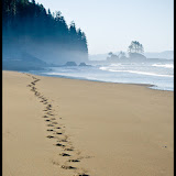 |
| Backpacking The West Coast Trail, Vancouver Island, British Colombia |